High-Precision Reality Capture for Architecture, Engineering, and Construction
We deliver accurate laser scanning, 3D documentation, and actionable site data that supports design decisions, reduces rework, and integrates cleanly into professional AEC workflows.
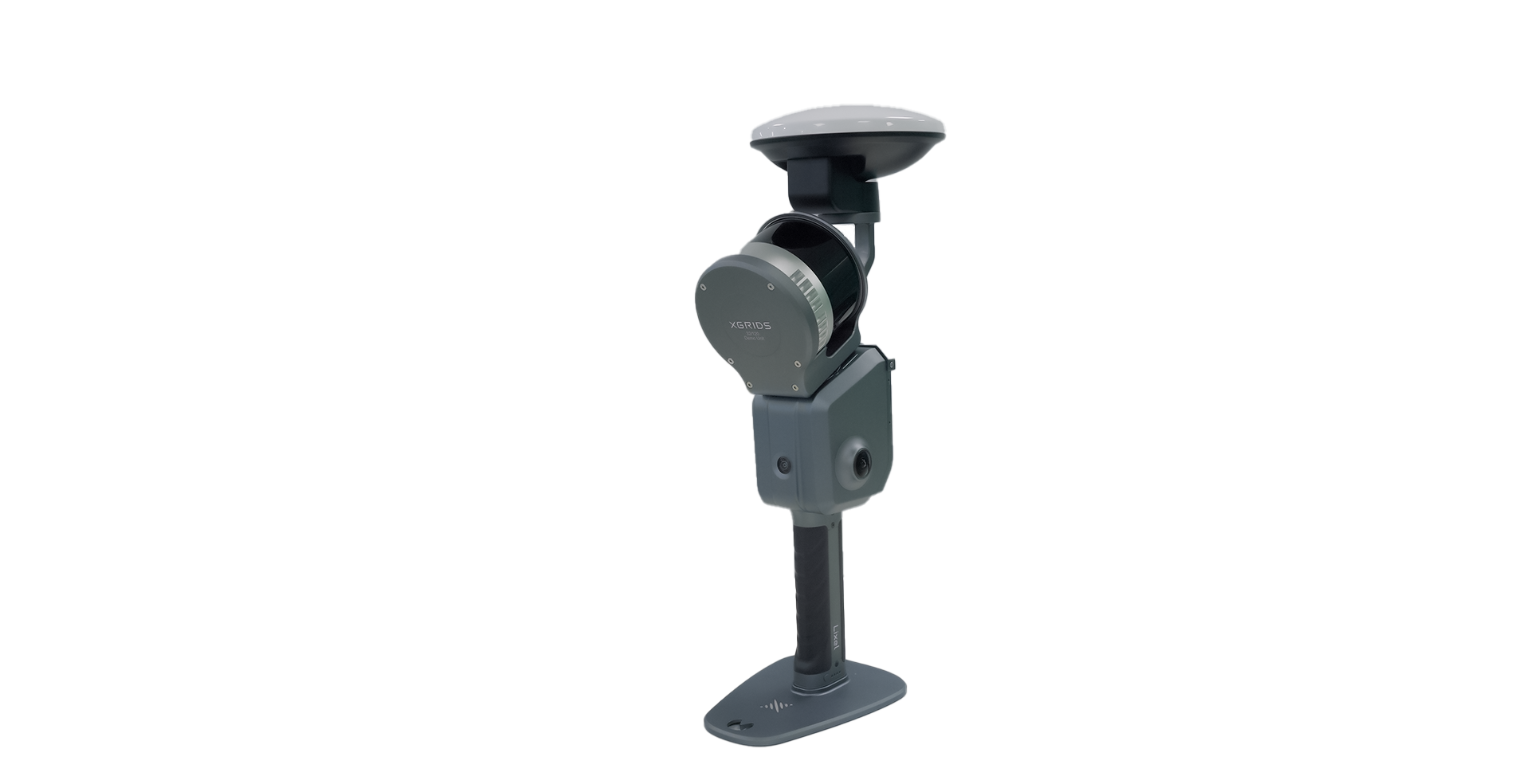
20-minute single scan captured with the Lixel L2 Pro 32/120
Reality Capture That Fits Your Workflow, Not the Other Way Around
We specialize in mobile and aerial reality capture, using both LiDAR and photogrammetry to balance efficiency and precision. Each technology is selected based on site conditions, required accuracy, and downstream use of the data.
Our workflows emphasize consistency, repeatability, and transparency so project teams know exactly what they are receiving and how to use it.
-
We are SLAM-based scanning specialists. We deliver high-density point clouds captured rapidly for interior and complex environments. Ideal for existing conditions documentation, renovation projects, and coordination models where speed and coverage are critical.
-
Large-area capture for site context, exterior conditions, facades, and terrain modeling. Well suited for campus environments, industrial sites, and infrastructure-adjacent projects.
-
Tripod-based scanning for projects requiring the tightest tolerances, delivering sub-millimeter relative accuracy. Best suited for structural measurement, MEP coordination, and high-precision as-built documentation.
-
Browser-based 3D environments that let project teams explore the site remotely, validate existing conditions, and share findings across stakeholders. No specialized software required.
We use 3D Gaussian Splatting models: photorealistic, real-time explorable 3D scenes generated from scan and image data using the XGRIDS Lixel ecosystem.
Deliverables Designed for AEC
Our deliverables are aligned with your formats and intended use, not just raw output.
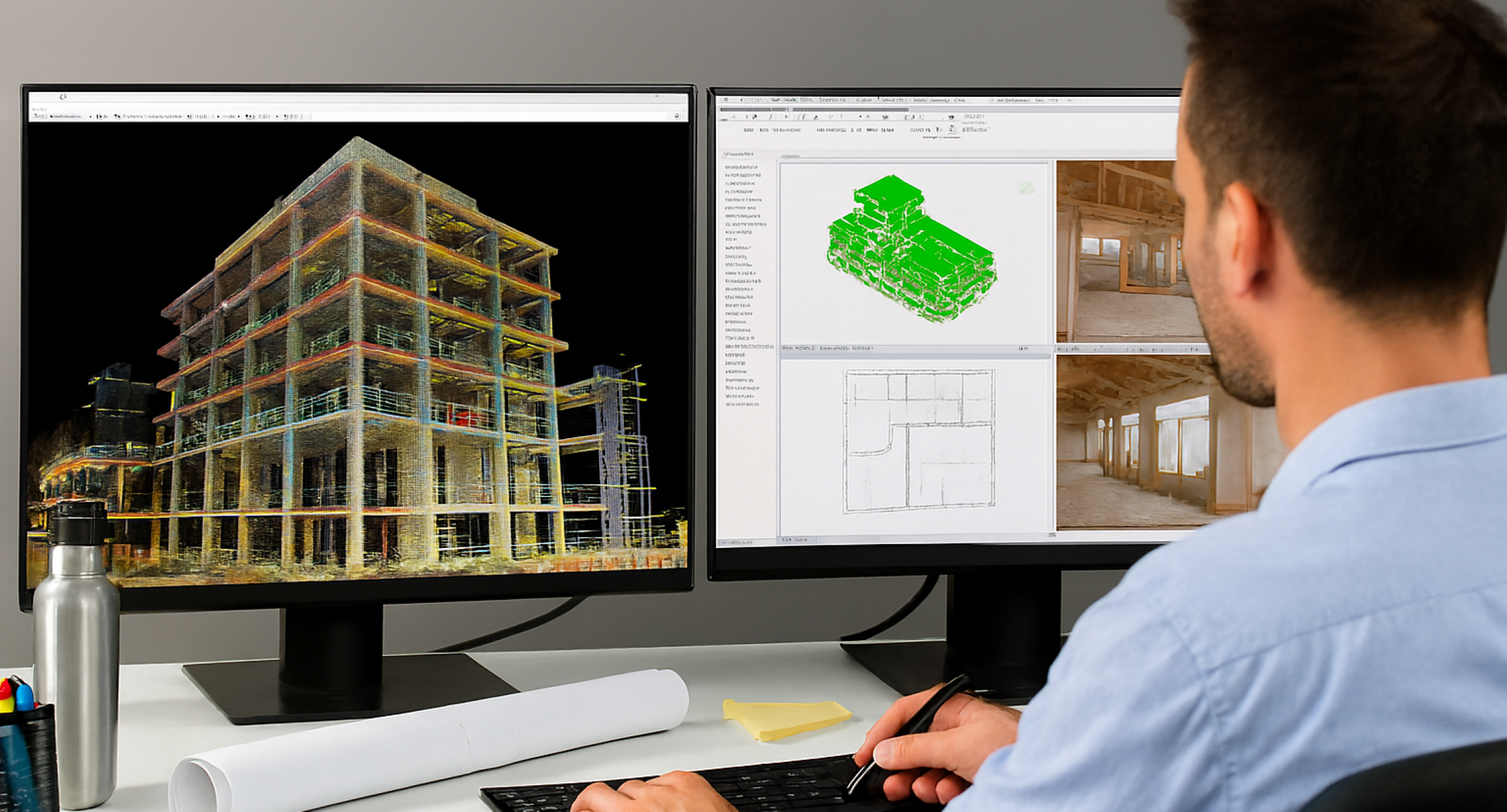
Registered Point Clouds
Clean, aligned, and georeferenced point clouds delivered in industry-standard formats including E57, LAS, and RCP/RCS, which are compatible with Autodesk workflows including Revit, Navisworks, and AutoCAD through ReCap processing.
Scan to BIM Models
Revit and IFC models developed to the level of detail appropriate for design development, coordination, or construction. Modeling scope and tolerances are clearly defined before work begins.
2D Drawings and As-Built Documentation
Floor plans, sections, and elevations extracted directly from point cloud data to reflect real site conditions.
Let’s discuss your project needs and how we can help. Call or text us at (801) 824-6162
3D Gaussian Splat Models
Photorealistic Gaussian Splatting, real-time explorable 3D scenes generated from scan and image data using the XGRIDS Lixel ecosystem. Ideal for stakeholder presentations, owner walkthroughs, and remote site review where visual fidelity matters as much as dimensional accuracy.
Site and Aerial Data
Orthomosaics, surface models, and terrain data that support planning, visualization, and contextual design work.
Interactive 3D Environments
Secure, shareable 3D views that reduce site visits and improve communication across project stakeholders.
Why AEC Teams Choose Alpine Reality Capture
Local to Utah with National Reach
Based in Draper, Utah, we provide 3D laser scanning and reality capture services across the Wasatch Front and statewide, and travel nationwide for large-scale commercial and industrial projects.
Built for Professional Projects
We work with architects, engineers, contractors, and facility teams who require dependable data, clear communication, and predictable delivery.
Safety and Compliance
Field operations follow OSHA-10 safety practices, and all aerial operations are conducted by FAA Part 107 certified pilots.
Clear Scope and Expectations
Accuracy targets, deliverables, formats, and timelines are defined upfront so there are no surprises during delivery.
Fast, Reliable Turnarounds
Typical point cloud delivery within 48 hours for standard projects, with schedules scaling transparently based on scope and complexity.
Quality Guarantee
If deliverables do not meet agreed specifications, we will correct the issue or recapture data at no additional cost.
Our XGRIDS Store
Alpine is an authorized XGRIDS reseller, an innovation leader in advancements in 3D geospatial data capture.